Winter will be on the average when low temperatures begin
Periskopi (5 years ago)
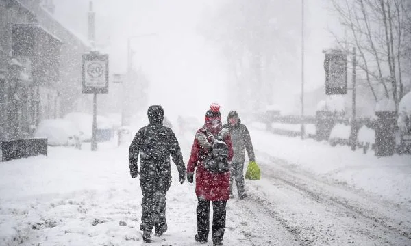
Kosovo is still a week apart from the winter season, and neither will this year be any different than other years, since the first half of winter will be at low temperatures. But at the beginning of next week the lowest temperatures will be on [...]
Kosovo is still a week apart from the winter season, and neither will this year be any different than other years, since the first half of winter will be at low temperatures. At the beginning of the next week, however, the lowest temperatures will be in the lower mountain regions, ranging from -3 ° C.E., while those higher regions will be somewhere - 6 or 7 degrees Fahrenheit [1 - 7 ° C].
So said Kosovo pris meteorologist Besim Aliu of the Kosovo Hydrometeorological Institute, which says what the winter season will be like, more precisely will be known after December 21st.
“We have a winter of rainfall above average -- the first part of the winter -- with temperatures that will be episoded, low but maintaining values of other years. But as for the rains, there will be more than the winter we left behind but that temperatures will be than they will until the end of winter. It is certain that after December 21st, we will give a more accurate prediction”, Aliu adds.
Ali reports that during the entire month of December, there will be temperatures of minus -4 and -5 degrees Fahrenheit [1 - 5 g].
So during this month we first had low rainfall temperatures somewhere -5 degrees Celsius, they're going to keep up this rate, but the particular thing is that we're going to have rainfall, which can endanger certain areas because we've had rainfall even earlier and now the earth is fed up with the amount of these rainfalls, and these rainfalls that are going to fall even at night can endanger some areas in Kosovo,<x1
It also shows that there will be rainfall early next week, but low snowfall will begin.
And we're going to have a weather mostly killed with a little bit of sunshine but that temperatures won't be high, they're going to move prey to between 1 and 3 4 degrees Celsius, whereas minimotives are going to be moving, somewhere -3 degrees somewhere in low regions, and in high places they're going to be anywhere -6 degrees or -7 degrees Celsius. But the particular thing is that the rainfall will go down, and their intensity will fall, and we will have rainfall again, but it will be snow-shaped but not high-intensity rainfall, because we've had it before and according to the numeric forecasts we'll have snow fjolla in the week we're entering”, he points out.
Furthermore, Aliu has also spoken of contaminated air, where he says that red light for this is only in the city of Gjilan, yellow light is in Mitrovica, while in other countries air quality is good.
The air quality at the moment in Gjilan alone is in the red light at the Gnjilan air station that shows it's in the red light, means that there's a bad air, and in Mitrovica that shows that we're in the yellow light that there is also relatively polluted air. And in other cities we're in the green light that shows that air is of good quality, thanks to the activity of these meteorological elements of wind and rainfall that are timely and weather pressure that is fluctuating, but we generally have a good quality of air”, he said.