Here is when first snow in Kosovo is expected to fall this year
Periskopi (5 years ago)
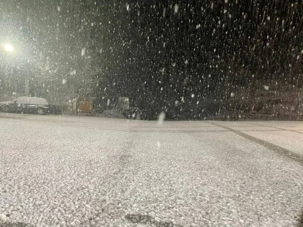
The atmosphere is expected to be extremely dynamic at the end of November and early December, and the models are almost “uniname” for this. Cyclonic air measures are expected to be empowered in our region by Friday, but rainfall will be mostly in the form of rain. Based on current synoptic performances about November 29th or 30th. [...]
Cyclonic air measures are expected to be empowered in our region by Friday, but rainfall will be mostly in the form of rain.
Based on current synoptic performance about November 29th or 30th, we are expected to have the first snow flags in many parts of the Republic of Kosovo, normally in many lowlands and snow in hilly-mountain areas under all odds is almost certain, however, this still remains only a prediction based on very serious signals from the world's best-known weather forecast models.
With the arrival of a very cold front at the beginning of the new week, the first snowfalls are expected and based on current synoptic performances after the passage of this front, we will have another Cyclon, which from Italy is expected to bring us atmospheric rainfall. The cold air will be present at the time new snowfalls are expected in early December.
That is more or less the synoptic situation expected at the end of this month and early December, and because of many questions, we came up with this post. Small changes in the prediction are still more than possible because it's a few days and for every major change and detail we'll be telling you over time.
In the end, it is still too early for the rainfall to be as accurate as it is to wait a day. /MeteoBalkan