Hard weather in Kosovo: In the second half of the week comes frost and ice days
Periskopi (5 years ago)
Pristina Weather has warned of lower temperatures in the second half of next week. According to them, minimum temperatures may drop even below - 10C on weekends. All of this as a result of the Spanish - based Cyclone Philomenia, which is expected to reach our country during tomorrow. Full announcement: After [...]
According to them, minimum temperatures may drop even below - 10C on weekends.
All of this as a result of the Spanish - based Cyclone Philomenia, which is expected to reach our country during tomorrow.
Full announcement:
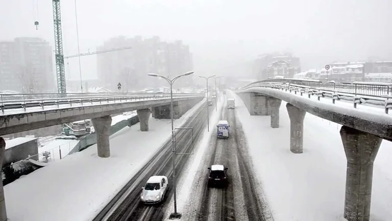
After the pees, frost comes in the second half of the week and ice days. At the weekend, minimal temperatures can also drop below - 10C.
10.01.2021 Cyclone Bartosh or the Philomena Storm as it was appointed in Spain these days, during the night and tomorrow it passes from our country. During the day of this day, rain is pouring, and rainfall can also become snow later in the night.
In the early days of the following week, our region still remains under the influence of crossing the region further south, and finally, the cold air masses will extend to our country, resulting in mainly climactic weather, sometimes even low local snowfalls. On Wednesday, crossing a cold front again presents opportunities for snowfall. In the second part of the week, Cyclones with cold air masses from the Arctic descend from our region, where they will allow colder weather and access to weak snowfall.
At the weekend, according to recent predictions, minimal temperatures are likely to drop even below - 10C, and negative temperatures may remain during the day, which are otherwise known as icy days.
The explosion of the Cyclones that are enabling a better air flow, is keeping the air pollutants more distributed, and the air quality index in the coming days remains in adequate and medium value, and countries will also go into poor and very weak.
1101 early in the morning, places of rainfall turn into snow. Hours mostly with scars. The day local rainfall, which changes into snow, places and ice rain.
12,01 B.C., mostly with scars, at times with the possibility of low local snowfall.
13,01 . . In part, you were killed, day with sun intervals. In the morning, in the lowlands, with the possibility of fog. In the afternoon and evening, low snowfall.
14,01 A.M.A., cloudy day, and evening with a potential for low snowfall.
15.01 a.m. colder, morning snowfall. Suntime intervals rest and are also expected.
Air temperatures gradually decline, with minimals moving from -5C to -1C, maximum between 0C and 3C.
It's going to blow up the light and average wind mostly from the 3-10m northeast.
Atmospheric pressure fluctuates around normal values.