Weather in Kosovo, sun and clouds

Periskopi (6 years ago)
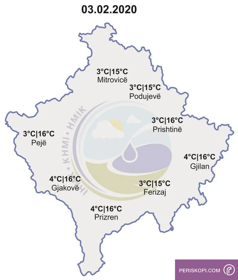
Sundays with high temperatures on average values are coming to an end. This is the result of cold air masses originally from the north of the continent. Monday and Tuesday will follow with high temperatures, but by Tuesday afternoon our country will [...]
Sundays with high temperatures on average values are coming to an end. This is the result of cold air masses originally from the north of the continent.
Monday and Tuesday will follow with high temperatures, but by Tuesday afternoon our country will be involved in low-pressure air measures, disrupting this current meteorological situation.
First, rainfall will begin, and with the strengthening of these polar masses, rainfall will flow into the form of snow.
Snowfall is envisioned Tuesday night Wednesday and the first part of Thursday. These rainfall will significantly affect changing the thermal balance, affecting the decline of temperatures in both extremes.
Minimum temperatures are projected to move between 4 and 7 degrees Fahrenheit [4 -7 ° C], while the maximum of the day is projected to move between 2-16 degrees Celsius.
Monday is represented by higher temperatures until Wednesday Day will mark only about 2 degrees Celsius.
This meteorological situation restores meteorological parameters to the averages of the season and month that we are in, but projected rainfall will be very welcome to meet the hydrical conditions, since it is known that our country has been in the deficit of rainfall since last year.
The biomethorological situation will be relatively good because of the presence of this meteorological activity. It will blow from the southwest and northwest direction at a speed of 1-15 m/s.