These will be temperatures

Periskopi (7 years ago)
These days our country is located between the low-pressure areas over the southern Mediterranean and the high-pressure areas that are extending over central and northern Europe of our region. Meanwhile, the warm air masses from northern Africa that produced spring temperatures will gradually be replaced by colder air measures, which are [...]
Meanwhile, the warm air measures from northern Africa that brought spring temperatures will gradually be replaced by colder air measures, which are descending from central Europe. Under these conditions, the week will start with mild weather, but after time with rainfall, and then temperatures will gradually drop around the average values.
Rainfalls are also expected in the middle of the week and in snowy mountains.
The powerful winds of the weekend improved air quality. The following days, it is designed to have sufficient air flow that will keep air quality quality in normal, but time after time it can grow even in unhealthy areas.
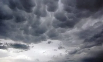
Today it will be mostly clouds, day and sun intervals, according to Pristina Weather.
Tomorrow was mostly killed and smelled. Rainfall time and snowy mountains. Later in the evening, mixed rainfall and snow.
On Thursday, the weather was mostly cloudy and sunny on Friday.
Air temperatures will gradually suffer decline over average values. Minimals will drop from 6C to 1C, and Friday to -1C, the maximum from 11C will drop to 4C to 7C.
It's gonna blow an average wind from the Northeast 3-9m/s, and on Wednesday strong until 13m/s.
Atmospheric pressure will mark increases on normal values.