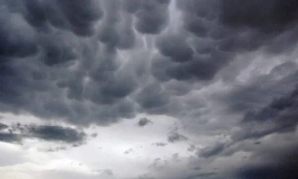
Thunder, lightning and hail the next few days... but what's coming for the weekend?
Periskopi (an hour ago)
As long as unstable conditions continue in us, Western Europe will face the second wave of heat this week, where temperatures are still expected to be around 40 °C, especially in parts of Spain and France.
However, the moon's day is being marked over our country by little sun and clouds, while late in the afternoon there may be some isolated rainfall in the northern and northeastern areas as a result of a cold, wet mass stretching across Central Europe and parts of the Balkans, both in Croatia, Bosnia and Herzegovina and Serbia, approaching the border with Kosovo.
These unstable measures will also be present in us in the following days, and temperatures will experience slight reductions in maximum values and more sensitive decline during rainfall.
So, under these conditions, Tuesday will follow with sunshine and clouds, while over the afternoon there are expected to be local rains of rain, not excluding hail in certain areas accompanied by lightning slides.
Even Wednesday, it will hold sunny weather and clouds, however, during afternoon hours a fresh air is expected to penetrate, which will bring local rains, lightning slides and small hail. These conditions in certain areas will be in the form of passing storms or storms.
On Thursday it will also hold sunny weather and clouds and locally with torrential rain and lightning.
Friday and weekend weather is forecast mainly with sun and heat.
The wind will blow mainly from the direction of the north, which at certain moments during conflict developments is expected to be quite powerful, or the light storm category, at speeds of 2050km perh.
Minimum temperatures will move from 11 to 17 °C, while maximum temperatures of 25 to 32 °C. /Meteo Kosovo/