Weather For Today and the following Days

Periskopi (8 years ago)
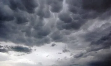
Over our region, unstable areas of low pressure continue to remain active that will favour changing weather, clouds and rainy storm developments. By mid-week the anti-cyclonic field from Central Europe will lie across the region, where in two days they will bring more stable and intervalent weather [...]
Over our region, unstable areas of low pressure continue to remain active that will favour changing weather, clouds and rainy storm developments.
By mid-week, anti-cyclonic fields from Central Europe will extend over the region, where in two days they will bring more stable weather and longer solar intervals.
Of the recent predictions, we can expect a flood of a cold front from the north of the continent on weekends, which will drop temperatures significantly below average value.
18.06 this morning you partially killed. During the weather day, mostly cloudstorms are expected, and rainy storms are expected in the afternoon.
19.06 minutes mostly with clouds. Local rain clouds are expected in the afternoon, and rainy storms are expected.
20,06-21. 06 minutes were partially killed, with longer sun intervals. On Thursday afternoon, there are opportunities for local rainfall around the mountains.
22.06 minutes partly killed. In the afternoon storms scattered with rain.
Air temperatures will mark growth, but will primarily fluctuate around average values. Minimals will be brought from 13C to 15C, the maximum from 24C to 27C.
It will blow the average and average powerful wind from the northeast 4-9m/s. Atmospheric pressure will gradually increase above normal values.