Weather forecasting, when is snow cut, and when does it rain?
Periskopi (a year ago)
After crossing the Cyclone and the cold front, temperatures decreased, but the weather improved dramatically today (of Sunday). Now we have short-term improvement in weather before the arrival of the new Cyclone, which will bring us new atmospheric rains. Since it will be mild cold and able [...]
After crossing the Cyclone and the cold front, temperatures decreased, but the weather improved dramatically today (of Sunday). Now we have short-term improvement in weather before the arrival of the new Cyclone, which will bring us new atmospheric rains.
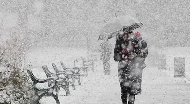
Since the evening will be mild cold and we may be stuck in cold air and in combination with early morning temperatures when the first morning rains come on the morning of the moon may be snow-shaped in many parts of the Republic of Kosovo, including areas in Dukagin, but during Monday day temperatures mark the rising and warm air of <x0x1> with the air mass guide from Italy and the Mediterranean can cause the transformation of snow in some areas, and this is very difficult to determine
After the mixed and rainy rains during the moon's evening we will have penetrated the newest cold airfront with northern winds, and this will condition new snow rains, but according to actual outcomes there will be no large snowfall. Over the next few days, we'll have several episodes of snowfall and layers but no big ones. An episode of snowfall can also be on Wednesday.
Massed and dense snow systems and large snowfalls will go further from Bosnia and Herzegovina, Croatia and Serbia, and that is exactly the mistake of models because these systems initially included Kosovo. We note, however, that we will also have snowfall in Kosovo, but not as in other parts of the Balkans mentioned above. At the end of the matter, we note that small changes can still be made and the amount of snow added to us as well, but this remains to be seen. /MeteoBalkan