The North enters the level of average risk, does not prefer travel to that part
Periskopi (3 years ago)
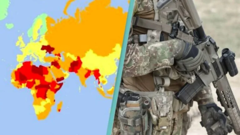
The international health and security service company “International SOS” has created a map to warn travelers and vacationers of risks to specific destinations. Risk has been determined at five levels through color, such as safe risk, lower risk, average risk, high risk, and extreme risk. At average risk, this map is [...]
The international health and security service company “International SOS” has created a map to warn travelers and vacationers of risks to specific destinations.
Risk has been determined at five levels through color, such as safe risk, lower risk, average risk, high risk, and extreme risk.
At average risk, the north of Kosovo has also been introduced on this map, where tensions are currently raised as a result of the establishment of barricades by Serbs.
In orange, representing the average danger, Mitrovica and Zvecani are involved.
And the average level of risk, the company has included the Presevo Valley and Sandzak.
Meanwhile, throughout the region, the level of risk of travel has been estimated low, as in other parts of Kosovo, excluding the north.
“Nivel of the risk posed to workers by political violence (including terrorism, uprisings, politically motivated protests and wars) as well as violence caused by smaller crimes”, the organisation's explanation reported.
This report suggests that the biggest change on the map occurred in 2021 because of the war in Ukraine.