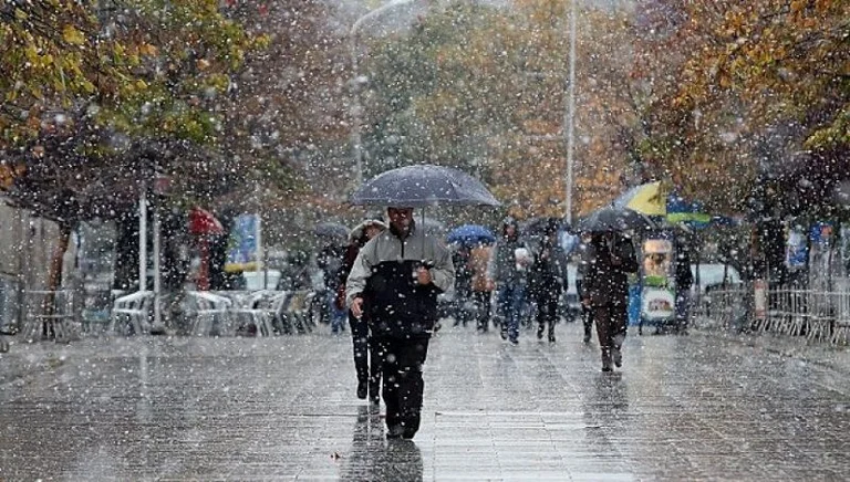
Weather for the next four days, snowfall expected
Periskopi (6 years ago)
The first days of February begin with mild, dry weather. Next week the polar cold is expected to take “to x1> over our region. The possibility of snowfall in the early days of February will also be dominated by high - pressure areas and warm air masses entering from [...]
The first days of February will be dominated by high-pressure areas and warm air measures entering from Western Europe. It will hold mild and cool weather, with temperatures significantly higher than average values, Pristina Weather suggests.
However, the meteorology service reports that “from Tuesday's evening, a powerful Cyclone from the North Atlantic will penetrate over our country, which will bring snowfall and from the continent's northeast to the middle of the week, will extend cold polar masses, while temperatures suffer severe declines to negative value. After these weeks of mild weather, the typical winter weather eventually reaches”.
According to the PW, day-to-day air quality values will swing around average values, but during the day they can also get off to goods and during the evenings they will pass into unhealthy.
Forecast for February 1-5th:
1.02 In the cold morning, passing clouds. On the day of mild weather, mostly sunny.
2,02 In the cold morning, in the lower parts, chance of fog. On a gentle day, with clouds and longer sunny intervals.
3.02 Bhut, mostly clouds, during the sunny interval day.
4,02-5.02 On Tuesday soft, cloudy and sunny intervals. In the evening it will blow, rainfall will be cut, which will later turn into snowfall. On Wednesday, cold, windy weather, sometimes snowfall. By Dukagini during the day of mixed rainfall and snow.
Minimum temperatures will be fluctuated from -2C to +3C, maximum from 12C to 15C, while the minimum Wednesday day will drop to 1C, at a maximum of 3C.
It's gonna blow up the light wind mainly from southwest 1-3m/s. On Tuesday and Wednesday it will blow the average and powerful wind first from southwest 6-25m/s, then northwest 5-11m/s.
Atmospheric pressure will grow above normal values, but as the Cyclone approaches, it will fall deep below these values.