Ukraine's destruction through new satellite images
Periskopi (4 years ago)
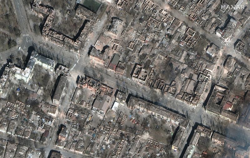
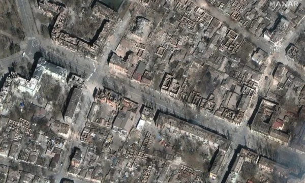
Blocks of neighborhoods in downtown Marioupolis have disappeared, at a level of destruction that had not been seen before in the Ukrainian surrounding city of satellite images by Maxar Technologists show recent-day updates confirming satellite data from NASA with dozens of explosions that have occurred in and around [...]
New satellite images by Maxar Technology show recent-day updates confirming satellite data from NASA with dozens of explosions that have occurred in and around Marioupolis.
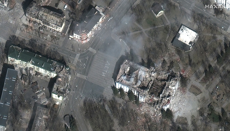
The area east of the bombed theater, where authorities believe about 300 people died in a Russian attack is in ruins. In a satellite image, roofs are either missing or severely damaged in almost every building.
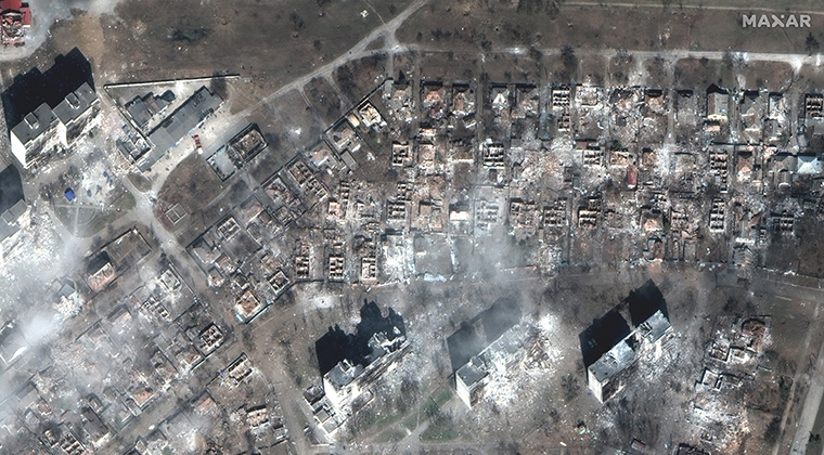
In the eastern Marioupolis, another residential area has suffered similar destruction. Every house surrounding two separate apartment complexes has been destroyed.
Another large apartment complex in southeastern Marioupoli, near the Azovstal iron and steel factory, has been destroyed. CNN has earlier confirmed that Russian troops and Chechen fighters have been active near that apartment complex.
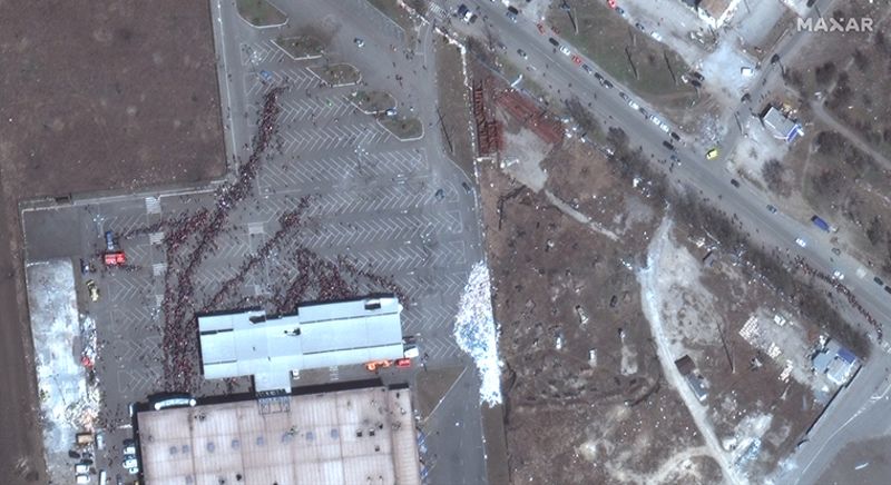
Satellite images also show survivors of the massacre.
Outside a supermarket in western Mariopoli, hundreds of people are seen gathered in line, waiting to enter the building. Its roof has holes in military attacks.
Marioupol's mayor estimated that 160,000 residents have remained in the city until Monday.
Only in the northeast of the city are Russian military positions seen, including vehicles parked directly near homes. The positions of the pulled artillery are seen only in the northeast.