Enjoy this weather today, and powerful destabilisation is expected tomorrow.
Periskopi (4 years ago)
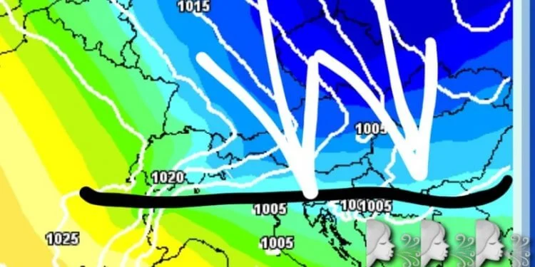
A bar plow from Scandinavian is expected to extend to our region, causing powerful weather destabilisation during tomorrow. First, winds will begin to blow from the southwest, which in only a few regions are expected to be powerful. And there will be gradual increase in clouds. Before [...]
Before the front comes it will not be cold, and as the front comes, powerful winds from the north will begin to blow, bringing us heavy snowfalls of temperature. Heavy snowfalls are expected in many parts of the Republic of Kosovo (not all over territory), north, northeast, east, southeast of Albania, northern Montenegro, Valley, and many parts of northern Macedonia. Not too low will not support snowfall in all the region's lowlands.
Wind speeds will fluctuate from 40 to 60 km/h in some areas, and during crossing the front may blow even harder. It is not ruled out for scarce material damage in any region during and after crossing the potential front. A cold day awaits us on Tuesday, with average winds up strong from the north and sporadical snowfall. From Wednesday we will have full weather stabilisation and temperature growth.
So enjoy the pleasant, stable weather today, as heavy clouds of rain, snow, and powerful winds await us tomorrow and especially during the arrival of the front when we may have snow with lightning and thunder. /MeteoBalkan