Sea deal with Greece, Albanian colonel: I feel surprised

Periskopi (8 years ago)
Sea Colonel Pasha told the newspaper “Panorama” that he is surprised by the untilymnipresent stand of many Albanian institutions, such as the Academy of Sciences, the Military Geographic Institute, the University of Tirana, the University of Polytechnic, but the Command of Marine Forces, which relates to studying Albania's maritime spaces, with legal recognition of the Law [...]
Sea Colonel Pasha told the newspaper “Panorama” that he is surprised by the untilymnipresent stand of many Albanian institutions, such as the Academy of Sciences, the Military Geographic Institute, the University of Tirana, the University of Polytechnic, but the Command of Marine Forces, which relates to studying Albania's maritime spaces, with the Law of the Sea Law recognition in the delegation with the neighbors of these areas.
According to him, in public they are clarifying negotiations with Greece only politicians, who do not really know the problem of calculating maritime borders, but also the content of the International Sea Convention.
He urges the government to consult with the Sea Forces Command whether it risks negotiations with Greece that Albania again lose its open-air water Syria. Stopping at the Becket Rock, Sea Colonel Myslim Pasha asks the Albanian government and negotiators not to implement the “Metode of the equivalent of”, as the application of this method in 2009 led to a distorted separation of the maritime border with Greece, losing large surfaces and Shelf Continental to serious consequences for the country's economy.
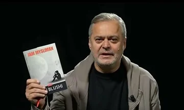
M YSLIM THE PLAY
And since 2009, it's about nine years... Just one sister, night and day at the top, washes graves with the natdo-year-old rocks, says one of the songs of the Wells and the issue of naval division, which is a diplomatic epiism, follows having such high sensitivity as the state does not function in the Pyramid of its structure. In the archive's sleep, it finds itself on guard for years just the Constitutional Court's decision.
They don't make the first statesmen of the Trade Pact comfortable. Meanwhile, negotiators who are still in institutions sleep comfortably, the Academy of Sciences, the Military Geographic Institute, University of Tirana, Polytechnic University. As far as the Sea Force Command is concerned, we stop somehow from entering military security terms... but I can also say an opinion about it: “In 2009 you lost Albania's battle and sea space, leaving it to the southern neighbour's invasion of”.
This is heavy but true! Who should ask the Marine Forces Command what military security investigations and what professional training has led them to face a new battle under preparation? Do we have the courage to announce or remember the ministers or former ministers for these “nine years”, which passed and we are not able to protect our Sea! ?
The government of what is now said: Albania we want! But is this: “Albania we want! ? When recently did the Greek Foreign Minister and after the meaningless wave of opinion have to appear the prime minister of Albania to clarify terms, principles, methods of approaching Negotiate? And no expert, no representative from these state institutions, has come out. This is too heavy! In all the media, TV shows, by many politicians who have been questioned have not clarified anything, they do not know the problem. This has led to the following demonstration of civil society, which has the motto: “Time is for bastards! But the sea is Albanian! ”
Baretta
No cartography has been conducted in the nine years for its hydrographic and graphic nature of the sea space, which was attempted to be released in 2009. Likewise, no measurements have been made with new electronic technologies and no particular discussion as to how the “Barketa” arose after the Reception Pact that further exists. Barcetta's geographical location is very important to treat as one of the times when the <x2matoda equivalent of equality” leads to a dead end. This approach led to “the peaceful loss of the Albanian Territorial Sea maritime space “.
“Barkata draws the familiar impression that the sea with this rock plays a continuous game, pulls it out, and puts it back into its bosom. It is an underwater marine rock and becomes a game of the tide process. This phenomenon in this area causes the tide level to rise to more than five feet [0.5 m]. This level draws near its drowning, which in the wave above the average hides in seawater. So it cannot be called an island, as is used in the cannons that are written.
The Albanians around here call it the Pleshtin <x0... What made an immediate impression, with the first glance, during the consisting and confrontation with the Detar Pact that was rejected, “s is it possible to measure sea division in the Ksamil Zone to start off this sea cliff (water shelf)? All are amazed, felt offended, conquered in their own sea. That's what happened in the Marine Pact of Betrayal. Now let us get acquainted with the size and acts of division that are insurmountable evidence.
2. What are the hydrographic and geographical units that surround this sea rock (seace)? In the East is the Cape of Mertresa (Ksamil- Albania), and as far south, it is the baseline of the Gulf of Tetrannis, which is the Closed Gulf. The closed Gulf line is just like the landspace of the Territorial Integrity. In the West is Corfu with Cape Varvara's unit, as well as in the northwest, the visible island, the divine hill, the Tignoso (Persitor), which is inland of the water, that is, beyond the perceived middle line.
Measures have been carried out from the Albanian coast with GPS (Global Posion System) by determining the geodesic positioning of the Barheta rock. On a Greek map, which is already located at the Military Geogenic Institute, measurements and approaches of the distance from which it flows: - Baretta-top baseline of the Gulf of Tetranitis is 900 meters. -Bacta- Cape Varvara is 1932 meters. The baretta, as the geometric center of the rock, is 32 feet [32 m] away - west of the Middle St. Who has the barketa” met?
Who annexes Greece with this sea market, located within Albania's sea waters? Meanwhile, the Florence Protocol is known to contain only one phrase: “Marine Navy documents are said to name this hydrographic unit belongs to Greece. 3. Albania only benefited 950m, and Greece's 2850m! !
In the Marine Pact, brought down by the Constitutional Court, in this entity alone, taking into account the method of equality, sea hammers (over), the same Territorial Sea standard, as opposed to the Ksamil Continental Dheu, Greece took advantage of that world of 2850mm, while Albania was only short of 950m of so shameful for Albanians). This is shocking evidence of why the Sea Agreement must be renegotiated for a fair and honest solution! Do the institutions of Albania that we want to hear? /Panorama/