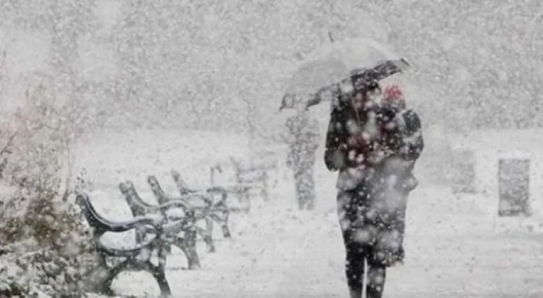
Cyclone approaching: Between Friday and Sunday intense snow and rain rains in mountainous areas up to 50cm
Periskopi (2 years ago)
A low - pressure atmospheric centre, originally from the Atlantic, has already included Western and Central Europe, while currently located in Poland, crossing from a cold front that is moving toward Southeast Europe. So on Friday, we'll have the penetrate of the cold invite from the early hours [...]
So on Friday, we're going to have a cold invite since the early 24 hours, bringing a significant drop in temperatures at maximum value, as well as intense rainfall and snow, including the weekend. At times, strong winds are also expected, at speeds of 30 to 50 km perh, and at certain moments up to 60 km/h in localities.
These measures will be weaker in thermal terms, meaning that temperatures are not expected to be low enough to favor snowfall in much of the territory and time. As a result, major rainfall may be in the form of rain or heat, reports Meteo Kosova.
However, even the only snowfalls will occasionally appear in low areas, especially on Saturday, where they can cover the entire country before they gradually return to late afternoon and evening rains.
Sunday remains most likely rainfall, and in certain areas of snowfall, especially on Kosovo Plains.
In these days, heavy snowfall is cut in mountain areas, where thickness can reach up to 50cm.
These rainfall results from slow - moving cycling over Greece, where more intense rainfall will occur, causing floods.