April can bring snow rains to Kosovo
Periskopi (3 years ago)
After improving the weather set before the next two days on Saturday we will have weather destabilisation as a result of the arrival of a cold air front, but this front will not bring severe temperature cuts. Local rains are expected in the afternoons during the weekend. At the start of the new week I will [...]
After improving the weather set before the next two days on Saturday we will have weather destabilisation as a result of the arrival of a cold air front, but this front will not bring severe temperature cuts. Local rains are expected in the afternoons during the weekend.
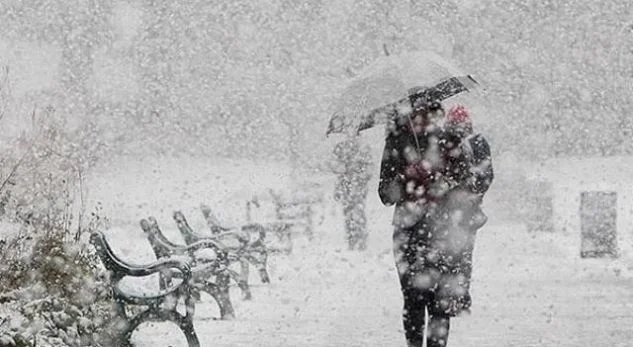
At the start of the new week, we will have the arrival of a much stronger, colder air front, which will be accompanied by powerful cycling measures in the Adriatic Sea, Ion and until east Europe, Bulgaria, Romania, etc.
This is the perfect synoptic state of snowfall in our region. As the front lines arrive, there will also be extremely cold polar masses that are not so common to this period of time.
Initially, the powerful front and cycle will condition heavy rainfall, while then snowfall is expected in many parts of the Republic of Kosovo.
Snowfalls are envisioned in Kosovo, northern Macedonia, northern Montenegro, east, wine and southeast of Albania and the Presevo Valley.
After the loss of snowfall, the weather clears up and then it can easily have a cold of one or two nights in the middle of next week.
Recently, there has been a kind of trend of late spring, and when there is no snow during the winter, then it's happening at the beginning of spring, and this is likely to happen this time.
Improved weather and rising temperatures are envisioned in the second half of the new week.
In the end, there may be changes in the prediction because it is a few days, but there can hardly be any major changes. Every evental change will be announced in time in our daily posts.