NASA publishes photos of the Vjosa River
Periskopi (4 years ago)
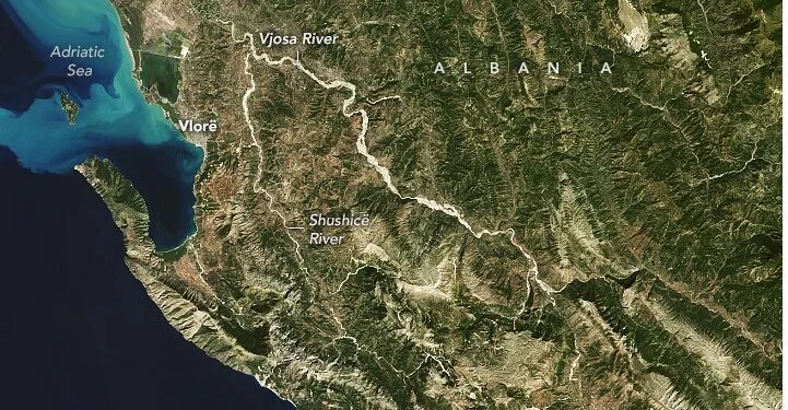
With a length of 272 kilometers [27 km], the Vjosa River is one of the only free flow rivers still found in Europe. From its sources in the mountains of Pindi, the river flows through northwestern Greece and then through southwest Albania. On September 9, 2022, Earth Operational Image (OLI) on Landsat 8 has [...]
From its sources in the mountains of Pindi, the river flows through northwestern Greece and then through southwest Albania.
On September 9, 2022, Earth Operational Image (OLI) in Landsat 8 has captured the image of the naturally colored Vjo River.
In Greece, the river is called Aoös and flows through the rugged terrain and thick forests of Vicos-Aoös National Park.
It joins a large branch (Sandapor) near the border with Albania and then sails through a sequence of steep canyons.
Although there have been plans to build hydropower plants and other projects in Vjo and its branches, Albanian authorities in 2022 signed the area becoming a national park.
In Albania the Vjosa River travels some 192km, passing through mountainous and field areas to its pour into the Adriatic Sea. In Albania, the two main contestants are the Drinos (also springing up on Greek territory) and the Sushica River, which lies between the mountains between Vlora and Gjirokastra. The middle of Vjosa is one of the most dynamic areas of the river. In this area the riverbed expands to over two miles [2 km].
Another Vjosa tribuer is the river Langarica, located on the upper valley near the city of Permeti.